Harrison Wilroy
Political Science and Geographic Information Systems
Education
Political Science Studies
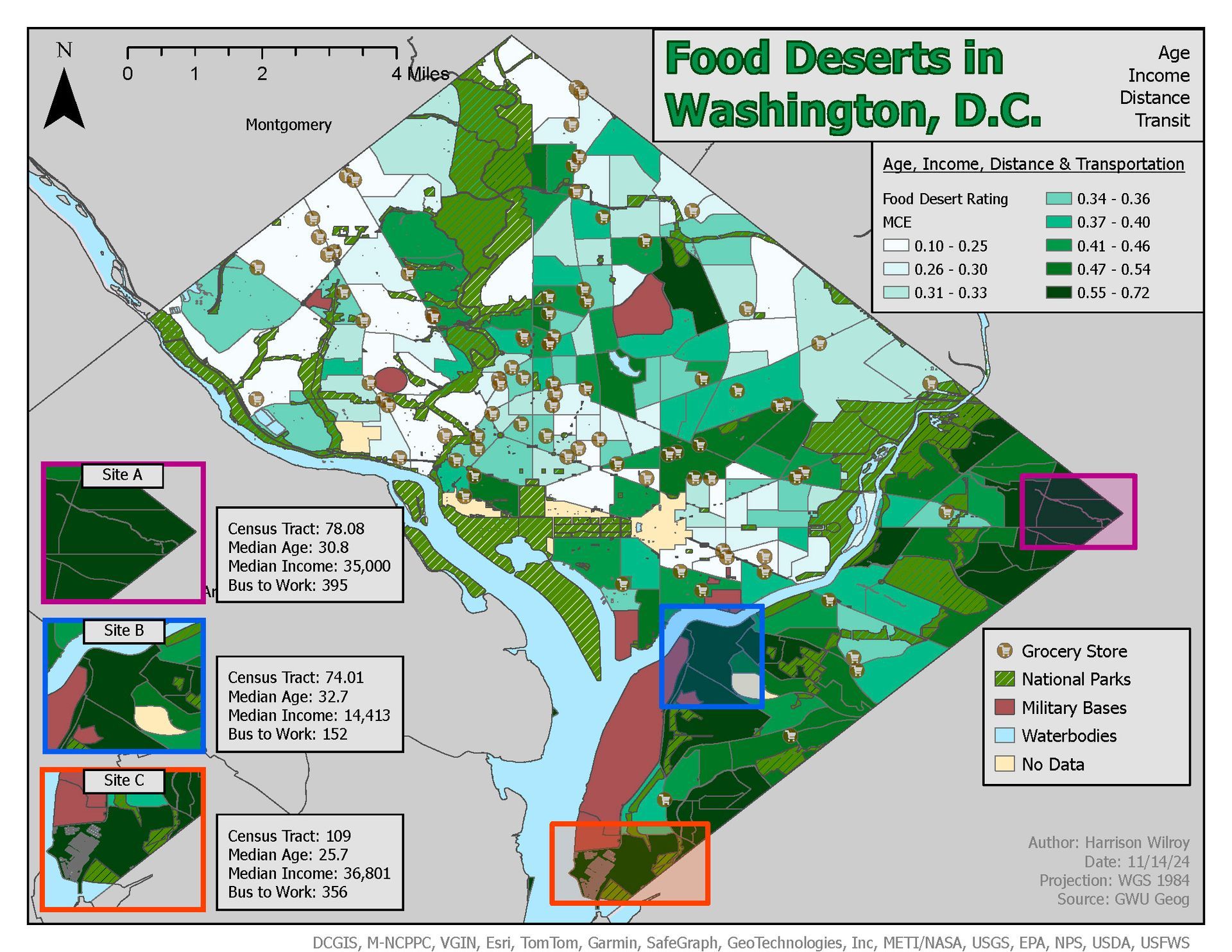
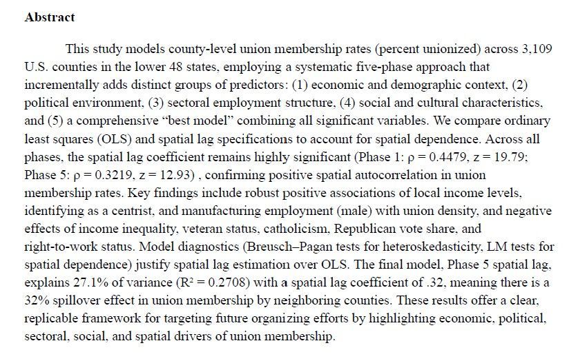
I studied a variety of topics in my undergraduate, from US domestic politics, to Central/South American state corruption and violence, to international relations in the MENA region. My final course, a Proseminar, was on labor politics where I conducted a semester long spatial analysis project to map union membership and its strongest predictors to better inform local organizing efforts on areas with high "action-potential".
I developed skills in advanced spatial analysis, raster modeling/3D modeling, scripting for geoprocessing, spectral analysis, change detection, database management, interactive mapping, principles of map design, and visual storytelling. I was primarily trained in the ArcGIS software quite, but am familiar with a variety of open-source tools. I'm also very familiar with Adobe Illustrator and Photoshop for creation of truly aesthetically pleasing maps.
GIS Research & Analysis
I took courses in calculus, advanced regression analysis, data visualization using R, and econometrics, which broadened my ability to analyze data outside of GIS and the social sciences. Despite these courses I graduated with a BA, why? In the spring of my junior year of college I decided to switch my BA to a BS, which required me to complete calculus 2, and then four higher level elective math/statistics courses. My senior year I was told techniques of spatial analysis and econometrics would not count toward those four higher level credits, to correct this I would've had to take an extra semester of school. Rather than take an extra semester I decided to graduate with a variety of STEM courses under my belt and a BA, but I am constantly working on my technical skills to make up for the lack of "BS" in front of my degree.
Portfolio in Progress...
I'm in the process of downloading and editing previous work to be up to par for display, integration into the site is also time consuming.

ABOUT
I’m Harrison Wilroy, a GWU Political Science graduate with a passion for Geographic Information Systems (GIS). I believe that understanding how data, people, and places connect is the key to creating smarter, more sustainable policy.
I've finished my undergraduate and am continually working on new skills, at the moment I'm improving my python ability as well as learning Power BI. I look to contribute meaningful insights, backed by data, whether that be in the public or private sector.